Dates
Address
Institutions
Blekinge Museum
Responsibles
Nilsson, Björn
Participants
Svensson, Andreas
Dell'Unto, Nicolò
Derudas, Paola
Dininno, Domenica
Fauvelle, Mikael
Paulsson, Jonas
The settlement at Västra Vång is placed in close proximity to the Johannishus ridge. This partly prominent esker constitutes the dominant landscape feature of the region, providing the north-south-running valley with its specific character through a combination of undulating high-points and formerly numerous wet-areas. The higher terrains east and west of the valley consist of woodland, whereas the valley itself is almost exclusively dominated by agrarian land-use. The archaeological landscape is characterized by graves of Bronze- and Iron Age date, placed at high-points in the terrain. The lower agrarian terrain within the valley shows evidence of settlement sites dated from the Neolithic and onwards. Only a few of these are surveyed and recorded. The Medieval village of Vång has not been affected by later agricultural land reform, and was since the 17th century, or possible earlier, divided into two units. One located east of the valley and one west. The village was since the late 17th century incorporated in and under the control of the estate of Johannishus. Evidence of earlier activity within the village have especially been recorded in connection with agricultural land surrounding the minor plateau in the middle of the valley (L1978:8860, RAÄ Hjortsberga 306 and surroundings). The investigation of these activities have produced dates from Pre-Roman Iron Age to late Viking Age.
The campaign of 2019 left several questions unanswered, specifically concerning the lower stratigraphy of the hill site. For this reason, a smaller excavation campaign, pinpointed at elucidating the thickness of the sooty organic layer and the depth, characteristics and stratigraphic position of the posthole, was executed in 2021.
The investigation area was delimited to the posthole and an area around the same covering 6 m2. This trench overlapped with previous excavations, but also include 1 m2 of as yet unexcavated area south of the posthole.
Methods
The trench (Trench A) opened within L1978:8860, RAÄ Hjortsberga 306 measured 6m2. Exposed contexts and finds were recorded in situ with Image-based-modeling. The excavation was then carried out with single-context method. Excavated fills and layers were dry-sieved. Sampling was made selectively and with the aim of future macro-fossil analysis.
Metal detection was systematically carried out within the predifined investigation area (L1978:8860). The retrieved finds were manually recorded using field maps and later digitized post-excavation. No detection points that were ascertained to be related to underlying archaeological contexts were excavated during the campaign.
The field- personnel consisted of a team from Blekinge museum and Lund University. Jonas Paulsson, Kula AB was responsible for and conducted the metal detection survey. Additional total-station survey was made by Niclas Olsson, Blekinge mätservice and conservation work was conducted by Max Jahrehorn, OxiderAB. The find-list was compiled by Andreas Svensson, Lund University. Visual inspection analysis of ceramics and burnt clay was conducted by Torbjörn Brorsson, Kontoret för Keramiska Studier. Public mediation was focused on a continuous exhibition of artefacts at Kallvattenkuren, Ronneby Brunnspark.
Action camera recording was carried out throughout the excavation within the DIAD project (Digital Integration Across Disciplines). The action cameras recorded audio and video of the archaeologists excavating the site.
The results of the 2021 campaign confirmed the interpretation of the posthole as being stonelined and probably representing several resettings of posts in connection with different phases of the structure. Hence, the posthole could not be related to just one or a few phases of the structure, but, most likely to all .
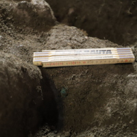
As for the sooty organic layer containing cauldron pieces, it could be concluded that it was slightly differing in depth, varying between 0,15 to 0,25 m in thickness (see Figure 14 and 16). As with the floor and leveling layers overlying it, differentiating between phases within the layer was difficult during stratigraphic excavation, considering the varying depth and mottled characteristics in terms of content. Contrary to what was hypothesized prior to the excavations of 2021, no additional cauldron pieces were retrieved from the sooty organic layer during this campaign. The excavations did however, record a number of such finds in situ. These were all recorded either within the floor layers overlying the sooty organic layer or in two pits dug into the floor layers excavated just south of the posthole.
Trench A was placed matching the location of the southeastern corner of Trench A from the campaigns 2017 and 2019. The topsoil was removed until the stratigraphy as of end of excavation 2019 was reached. An IBM acquisition was made before topsoil removal. Depth of topsoil ranging between 0,20 m to 0,30 m. The exposed surface was manually cleaned and an IBM acquisition was made.
The trench was then extended in the southern corner by 1,00 square meter in southern direction. The topsoil in the extension was removed and the surface manually cleaned, after this another IBM acquisition was made. The full extension of Trench 2021 had an rectangular shape with a breath of 2,00 meter, and a lenght of 3,00 meters.
The sooty layer context 1013, the posthole context 1031 and the newly one square meter located in the southeastern corner were all excavated simultaneously.
After topsoil removal, context 1005 was identified. 1005 corresponds to the upper floor layer surface recorded in the west extension of the trench excavated during the campaigns of 2017 and 2019.
Similarly to the excavation of 1005 during the previous campaigns, several finds were recorded in situ and/or retrieved from the context (Finds A1, A2, A3, A15, A16, A17, A18, A19, A20, A22, A23, A24, A25, A26, A27, A28). These finds consisted mainly of copper-alloy and iron fragments interpreted as pieces of fragmented cauldrons. In addition, one gold foil figure (A16) and a piece of ceramics were retrieved.
Many of the cauldron fragments could possibly have been deposited in pits dug into the floor layer rather than in the floor layer itself. It was, however, difficult to distinguish proper pit cuts during the excavation of the floor layer. This could be due to the floor layer consisting of several thin floor layers, one or many of which could overlap the pit cuts.
One such pit was successfully recorded as cutting through the floor layer, context 1042. The pit had one fill, context 1038, which was composed of a dark-grey silty clay with inclusions of small pebbles, charcoal and larger stones. Several finds were retrieved from the pit fill. The finds consisted mainly of copper-alloy fragments interpreted as cauldron parts. In addition, a few fragments of burnt bone, daub and clip scrap in gold were also retrieved.
At the bottom of the pit cut find A14 was recorded as deposited beneath larger stones. This testifies to a depositional practice of fragmented cauldron parts in pits dug through the floor layer and then filled with stones.

test


")
| Plane | Position | Flip |
|
|
||
|
|
||
|
|
| Show planes | Show edges |
0.0
[ 0 , 0 , 0 ]