Dates
Address
Institutions
Blekinge Museum (Sweden)
Responsibles
Nilsson, Björn
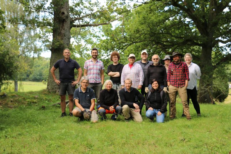
Participants
Dell'Unto, Nicolò
Ekengren, Fredrik
Hansson, Martin
Löfving, Axel
Gustin, Ingrid
Derudas, Paola
Helgesson, Bertil
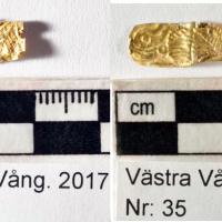
Ericson, Tyra
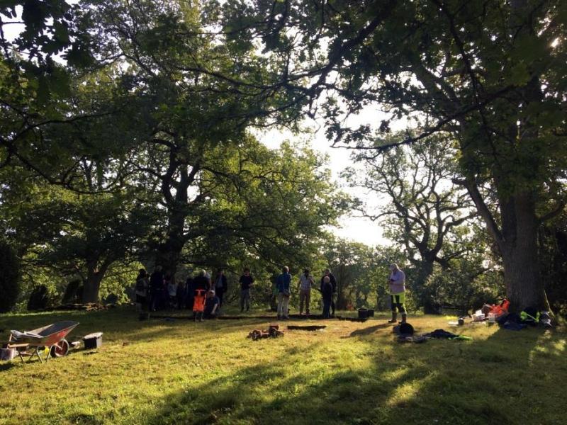
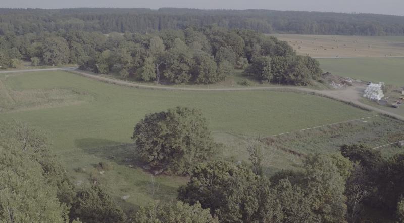
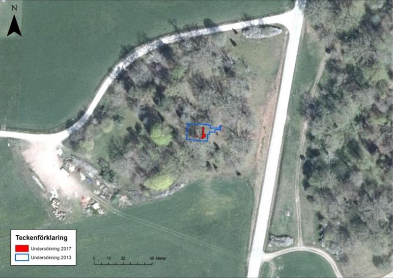
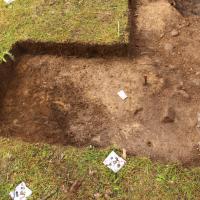
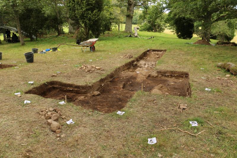
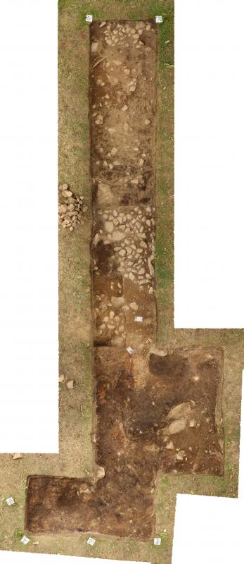
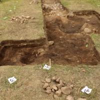
This report concerns the excavation activities carried out at Västra Vång in trench A during the excavation campaign 2017.
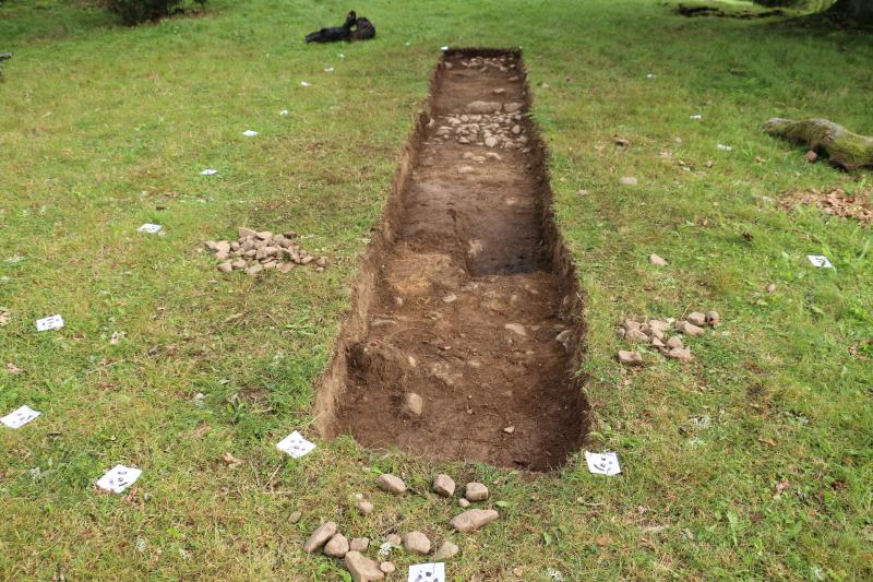
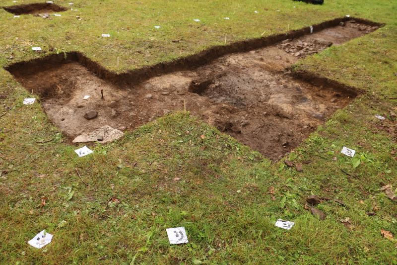
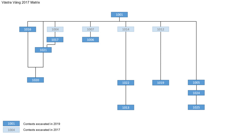
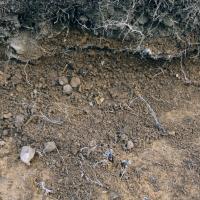
In the southeastern part of the trench, it was excavated context 1006, silty sand fill with humus, interpreted as the top-fill of a pit or top part of a single pit fill.
The pit was not fully excavated in 2017. It presumably cuts context 1013, but it needs to be established by fully exposing 1013 and excavating the pit containing 1006.
Westside to context 1006 was excavated context 1007, sand humus, with few burnt bones and copper-alloy fragments; this context was interpreted as a root disturbance.
Westside to context 1007, it was highlighted and excavated a patch of fine san, context 1012, interpreted as small patch of a levelling layer.

In the northern part of the trench, context 1016 was exposed, interpreted as part of larger stone construction discovered in 2012/2013 composed of fist-sized stones with humus soil mixed in. It appeared to be very similar to context 1017, a context exposed in season 2013 and partially excavated in 2017. Two stones from the north border of the stone packing were removed for geo-sampling, whereas the context was truncated to investigate the stratigraphy through a section. The context continues in both east and west part of the trench.
In the southern part of the trench, context 1013, a sooty layer in the southern part of the trench, was identified as the context exposed to extract some artefacts in 2013; it was only partially exposed in 2017 and not excavated.
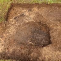
Northside of context 1013, it was excavated context 1022 , a yellowish silty layer very compact and with brown patches, was interpreted as a possible floor layer distinguish in two phases: the first phase (under layer 1013) included finds 41,42, the second one on top of 1013 is probably a second floor or a "repatched" floor.
Context 1019, located southside context 1013, is a gravely thin layer composed of the moraine, stone and sand, interpreted as a small levelling layer.
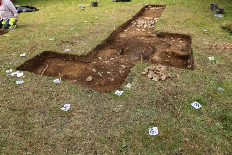
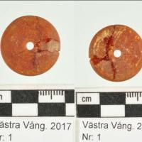
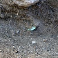
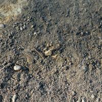
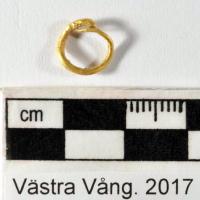
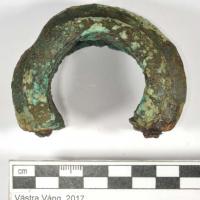
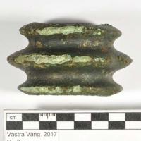
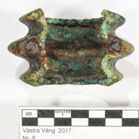
Layer 1005, a silty sand layer located in the southern part of the trench, proved to be very important since the beginning: several valuable finds have been retrieved in it.
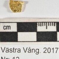
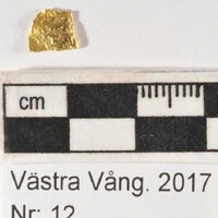
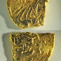
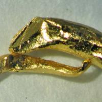
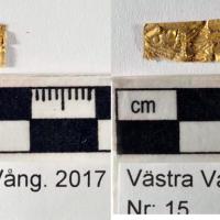
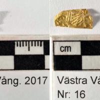
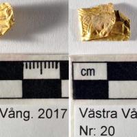
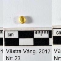
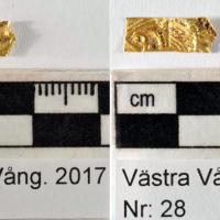
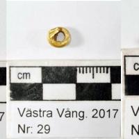
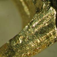
The excavation of context 1005 allowed to retrieve several gold artefacts, mostly in the form of foil figurines (A5, A9, A15, A16, A18, A20, A25, A28 and A35) spirals (A6 and A29) a droplet (A20), and a ring (A14).
The context continues beyond the trench limits in all directions.
This richness in the artifacts lets to hypotize, for this context, a connection to cult activities that need to be further investigated in future research.
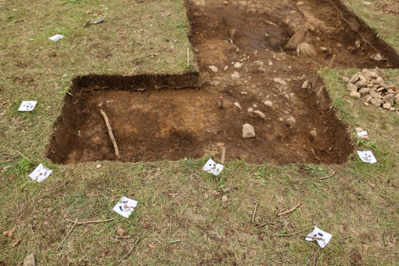

South of context 1017 is located context 1021. It is a light brown, silty layer that was only partially excavated; the layer was recognized as the result of a test pit.
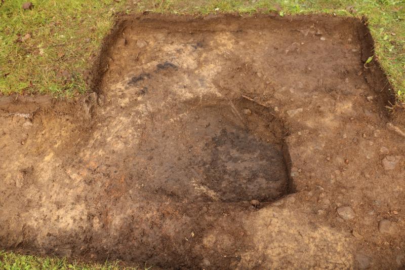
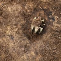
Context 1024 is a smaller sub-circular cut located in the southern part of the trench. It is a pit, the result of previous years extraction of a bronze mask. It was filled by 1005 with finds of glass and gold foil figurines.
In the northern part of the trench, between stone pack 1016, 1017, it was identified context 1020: it was cleaned but not excavated. It might be the top of the storey layer.
Context 1025, is a silty sand layer extending in the southern part of trench A, below 1024. The layer, not excavated in 2017, is possibly extending further north. This should be verified by future investigations.


")
| Plane | Position | Flip |
|
|
||
|
|
||
|
|
| Show planes | Show edges |
0.0
[ 0 , 0 , 0 ]