Identifier
en
TARP2023_SU_10017
Title
en
TARP2023 Stratigraphic Unit 10017
Phase type
en
Fill
Description
en
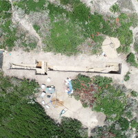
SU 10017 represents a thick layer of topsoil covering both the north and south sides of Extension A, roughly equivalent to SU 10001 and SU 10002. Because we excavated SU 10001 without sieving or counting buckets, we did both for SU 10017, though SU 10017 possessed a relatively low amount of cultural material. We did find a bronze coin on the surface of SU 10017 right as we started excavating, though without a secure context it is not of much use.
Record creator
Investigation site
Date Created
May 30, 2024
Rights Holder
en
University of Cincinnati (US)
License
en
CC-BY 4.0
has type
en
Topsoil
O17i_was_generated_by
AP16i_was_attributed_by
en
R10.9
AP5_removed_part_or_all_of
Linked resources
| TARP2023 Phase R10.9 |
| TARP2023 Trench 10000 |


