en
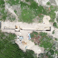
SU 10029 represents an equivalent fill to the two other leveling/construction fills (SU 10011 and SU 10024) that were piled up against wall SU 10047 in the western walled structure. SU 10029 consists of the same very loose soil matrix as SU 10011 and SU 10024, but possessed far fewer stones, which is evident by looking in the scarps. There were several huge (20-30cm) chunks of mortared plaster in the surface of SU 10029, but no more were found lower down. As with SU 10024 and SU 10011, SU 10029 went to about the bottom of the lower foundation course of the wall. SU 10029 also corresponded largely to the portion of the fill against the abutting wall segment in the south (10047). Even though this wall segment must have post-dated the main construction, we still found no evidence of a different construction event or trench.


")