Identifier
GH2022_Ship_Area1
Type
Title
GH2022 Ship area 1
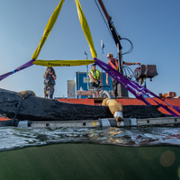
Description
The shipwreck area in its entirety as documented in 2019, with the location of the guns and repositioning made in 2021.
Record creator

Investigation site
Gribshunden
Investigation dates
August 22, 2022 – September 2, 2022
Investigation technique
en
dredge
Model measure unit
en
meter
Longitude shift
513000
Latitude shift
6222000
Spatial reference system (EPSG)
EPSG:3006
Date Created
August 25, 2022
Rights Holder
LU
License
en
CC-BY 4.0
Linked resources
| GH2022 Sample 10 |
| Gribshunden Campaign 2022 |
| GH2022 context 3000 |


")
| Plane | Position | Flip |
| Show planes | Show edges |
Measured length
0.0
0.0
Coordinates (EPSG:3006)
[ 0 , 0 , 0 ]
[ 0 , 0 , 0 ]