en
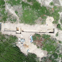
SU 10038 represents a greyish-brown fill of cut SU 10039. SU 10038 and SU 10039 appear to be a substantial layer cutting into the red soil underneath. We noticed both digging through 10037, under which we found a reddish soil layer with a distinct cut (10039) along the northern side, filled by a greyish brown soil (10038). SU 10038 revealed moderate amounts of material culture, including 1 coin. SU 10039 was an uneven cut only 5cm deep at the western end but cut to approximately 20-30cm throughout much of the layer. Because only an edge of the cut is preserved, it is difficult to say for certain what the extent or purpose of the cut or its fill would have been. At the bottom of cut SU 10039 in the west is a very compact grey clay layer; whereas in the east, the bottom of cut SU 10039 is a softer, light brown layer.


