en
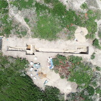
SU 10031 represents a deep fill in the northern half of Extension B, corresponding roughly to SU 10032. The soil matrix of SU 10031 is very loose, with high amounts of pottery and ecofacts throughout. A number of small finds have also been found in SU 10031, in particular bronze and iron nails, along with several coins. SU 10031 appears to constitute a filling/leveling event that abutted or covered the mortared wall construction SU 10062, though the exact stratigraphy and relationship is still somewhat opaque, given the poor preservation and unclear boundaries of SU 10062. SU 10031 sits on top of an earlier surface, better preserved to the south of SU 10062 as SU 10035. SU 10062 seems to have been built on top of the level of SU 10035, meaning that SU 10031/10032 postdate the construction of SU 10062.


