Identifier
GH2019_T_1_L2
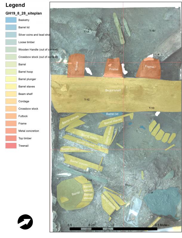
Type
Title
GH2019 trench 1 layer 2
Description
The second layer of the rectangular 6 x 2-meter large trench excavated on the starboard side amidships with NW-SE orientation.
Record creator
P. Derudas


Investigation site
Gribshunden
Investigation dates
August 28, 2019
Investigation technique
en
dredge
Model measure unit
en
meter
Longitude shift
513000
Latitude shift
6222000
Spatial reference system (EPSG)
EPSG:3006
Date Created
May 11, 2021
Rights Holder
LU
License
en
CC-BY 4.0
Linked resources
| Gribshunden Campaign 2019 |
| GH2019 layer 2 |
| GH2019 layer 2 timber |


")