Identifier
Title
Description
All diving conformed to the Swedish diving legislation AFS 2010: 16 and was planned and risk-assessed accordingly. The 2021 activity was conducted by a team of maritime archaeologists and specialist professional divers. This entire group has worked together on Gribshunden in 2019 and 2020. Several team members have worked together extensively on complex international archaeological operations. All of the archaeological divers carry the S30 Scientific Diving qualification, or equivalent (or higher). In addition, four team members hold S30 and A40 Dykledare certifications, or beyond.
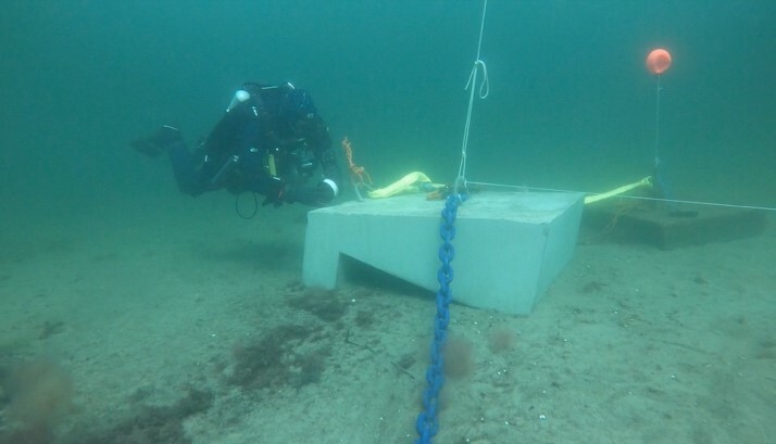
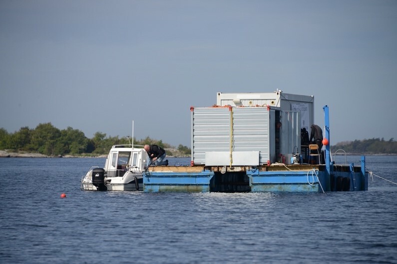
Diving was performed from a barge moored over the wreck site, equipped with an office trailer and an equipment locker. This provided a stable all-weather platform to support operations. To secure the diving support platform over the site, we positioned four 1.5-ton concrete moorings equipped with proper ground tackle consisting of 2.75 m of 20 mm short link chain, connected to the blocks with 22 mm (7/8 inch) screw-pin bow shackles (see figure 5a and figure 5b). These heavy moorings can secure larger surface support platforms, and are an investment in the future of the Gribshunden project.
Metal detection: The divers deployed Aquascan AQ1B metal detectors as described in Blekinge Museum Rapport 2021 : 4. The metal detectors identified a metallic target that proved to be a large wrought iron artillery piece at the port quarter of the wreck previously discovered during the 2020 campaign. The detectors also indicated strong metallic targets within the excavation trench, which proved to be an iron anchor and an iron tube or rod. Both of these features extended beyond the limits of the trench, and were left in situ.
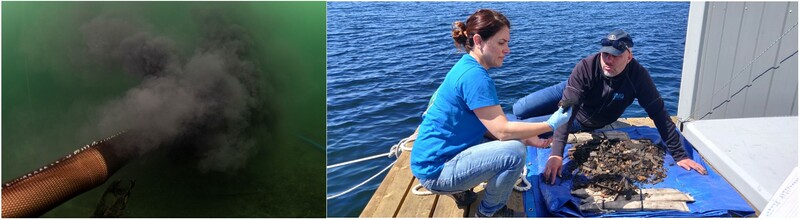
Excavation Equipment: The team utilized a hydraulic dredge fed from the surface by a gasoline powered water pump. The excavating archaeologists took utmost care to prevent any important material from being drawn into the dredge; but despite best efforts some objects inevitably did travel through the dredge. The risk of information loss was minimized by attaching a mesh bag to the effluent end of the dredge. This captured any small artifacts inadvertently missed by the excavators, while allowing sediment to disperse. The mesh bag was recovered at the end of each dive cycle, and the material sorted by hand on the diving support platform (see figure 6).
Diving Equipment: The diving methods consisted of open-circuit scuba and closed-circuit rebreather, as described in Blekinge Museum Rapport 2021 : 4.
Dive Recording: Each dive team was equipped with at least one head-mounted video camera (Paralenz or GoPro) to record all activities underwater. Video files are archived at BM and LU.
Site Recording: The excavation was documented by digital still photography and video, similarly to the 2019 campaign. Lund University researchers processed the data to create photogrammetric models of the trench in a time series, following the excavation progress.
Water Quality Assessment: We deployed from the deck of the support platform water quality sondes connected to a YSI ProDSS instrument. The instrument recorded GPS position, time, and barometer reading. The sondes connected to the instrument by a cable measured pH, Oxidation Reduction Potential (ORP), Optical Dissolved Oxygen (ODO), salinity, conductivity, temperature, depth, conductivity and resistivity. The procedure is as described in Blekinge Museum Rapport 2021 : 4.

Set 3DHop scene
Record creator
Date Created
Rights Holder
License
Linked resources
| GH2021 Report 2 |


")