Identifier
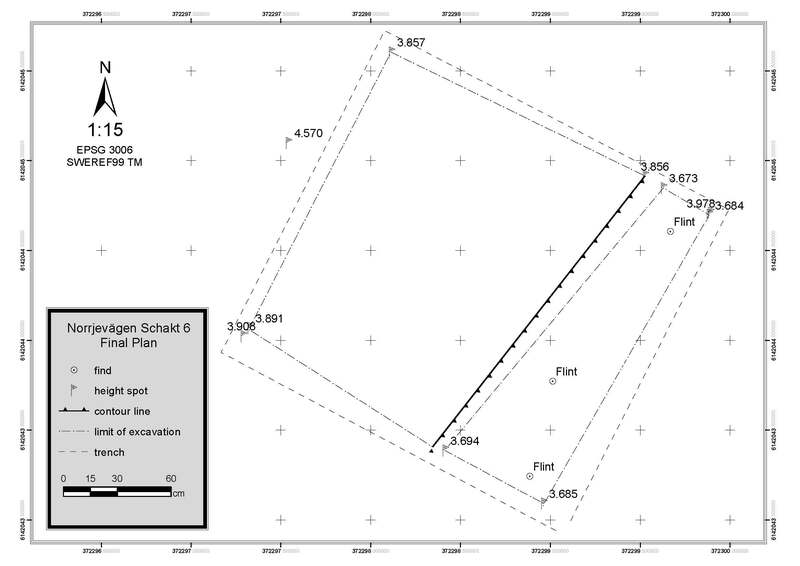
KMP2014_T6
Type
en
shovel test
Title
KMP 2014 trench6
Description
Trench 6 was positioned in the northeastern part of the investigation area, just outside of the actual farm as it appears in the air photo from the middle of the 20th century (see photo). In this area of the site, we initially opened up a 2m x 2m trench. Immediately underneath a 0,35 m thick plow layer, a layer of light, sandy humus covered most of the trench floor (Layer 2). In the northeastern part of the investigation area, the hard and light silty layers that dominate further west, for instance, Trench 11, are missing. This is probably due to the fact that Trench 6 was positioned outside of the actual farm yard area (see air-photo). This layer was initially excavated in 1m2 digging units. The trench was carefully excavated with trowels
Record creator
Investigation site
Kämpinge
Investigation dates
May 2014 – June 2014
Investigation technique
en
trowel
Model measure unit
en
meter
Longitude shift
372000
Latitude shift
6142000
Spatial reference system (EPSG)
EPSG:3006
Date Created
June 23, 2022
Rights Holder
LU
License
en
CC-BY 4.0
Linked resources
| Kämpinge 2014 |
| KMP2014 context 6001 |
| KMP2014 context 6002 |
| KMP2014 context 6003 |
| KMP2014 find A004 |
| KMP2014 find A005 |
| KMP2014 find A006 |
| KMP2014 find A448 |
| KMP2014 find A449 |
| KMP2014 find A450 |
| Test Kämpinge report |
| KMP2014 GIS data 01 |
| KMP2014 trench 6 01 (3D model) |
| KMP2014 trench 6 02 (3D model) |
| KMP2014 trench 6 03 (3D model) |
| KMP2014 trench 6 04 (3D model) |


| Plane | Position | Flip |
| Show planes | Show edges |
Measured length
0.0
0.0
Coordinates (EPSG:3006)
[ 0 , 0 , 0 ]
[ 0 , 0 , 0 ]
Check All


