Identifier
en
TARP2023_SU_10072
Title
en
TARP2023 Stratigraphic Unit 10072
Phase type
en
fill
Description
en
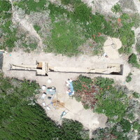
SU 10072 represents the fill of cut 10039 (therefore equivalent to 10038). The soil matrix of 10072 was a loose light greyish-brown soil, with little cultural material and low amounts of small rocks. 10072 and 10038 were not deep, extending only 10-20 cm to the bottom of the cut and the next layer. We halted excavation at this point for safety reasons, so cannot say what layer is underneath 10072. Although we were able to follow more of the cut 10039 with the excavation of 10070 and 10072, and can now see that it is roughly circular, we do not have any more clarity on the purpose of the cut 10039 or its fill.
Record creator
Investigation site
Date Created
May 30, 2024
Rights Holder
en
University of Cincinnati (US)
License
en
CC-BY 4.0
has type
en
Generic Fill
O17i_was_generated_by
en
Creation/Construction
AP16i_was_attributed_by
en
R10.3
Date
April 7, 2023
AP5_removed_part_or_all_of
Linked resources
| TARP2023 Phase R10.3 |
| TARP2023 Trench 10000 |


| Plane | Position | Flip |
| Show planes | Show edges |
Measured length
0.0
0.0
Coordinates
[ 0 , 0 , 0 ]
[ 0 , 0 , 0 ]
Check All


